Southwest Roadtrip

The Southwest
The Southwest is a playground of incredible rock formations, other worldly deserts and endless highways. The region overlaps several states, includes many Native American reservations and is home to some of the country’s most cherished National Parks.
Road Trip
There’s something so freeing and spontaneous about road trips: listening to good music, driving with the windows down, stopping at roadside attractions and drive through meals. With Devin and his brother, Desmond, we booked a one way flight from NY to LA, rented a car once we landed and made the rest up as we went. For about 10 days, we drove though Southern California, into Nevada, Utah and all across Arizona. I even used this trip as an opportunity to roll out the retro vibes with my polaroid camera and fanny pack.

Southern California
Los Angeles
After landing in LA, we drove to where Route 66 meets the Pacific Ocean, Santa Monica, a fitting start to our road trip. We spent the evening walking the pier, listening to the electronic violinists perform and watching the ocean tide roll in. For dinner, we ate at The Lobster, a staple seafood destination overlooking the pier. Here we treated ourselves to some West Coast seafood while drinking a couple rounds of Pacifico before calling it a night.
Randy’s Donuts
The next morning, on our way out of the city, we stoped at the original Randy’s Donuts in Inglewood for breakfast. Randy’s is a landmark donut shop easily recognized by the massive donut resting on top of the bakery. It’s been featured in video games, movies, tv shows and referenced across Hollywood. We ordered a half dozen classic glazed donuts and coffee. Randy’s took it a step further and gifted us another box of artisanal donuts including: fruit loops glazed, apple fritter, sprinkled, blueberry iced and devil’s food. They hardly survived the first day of driving.

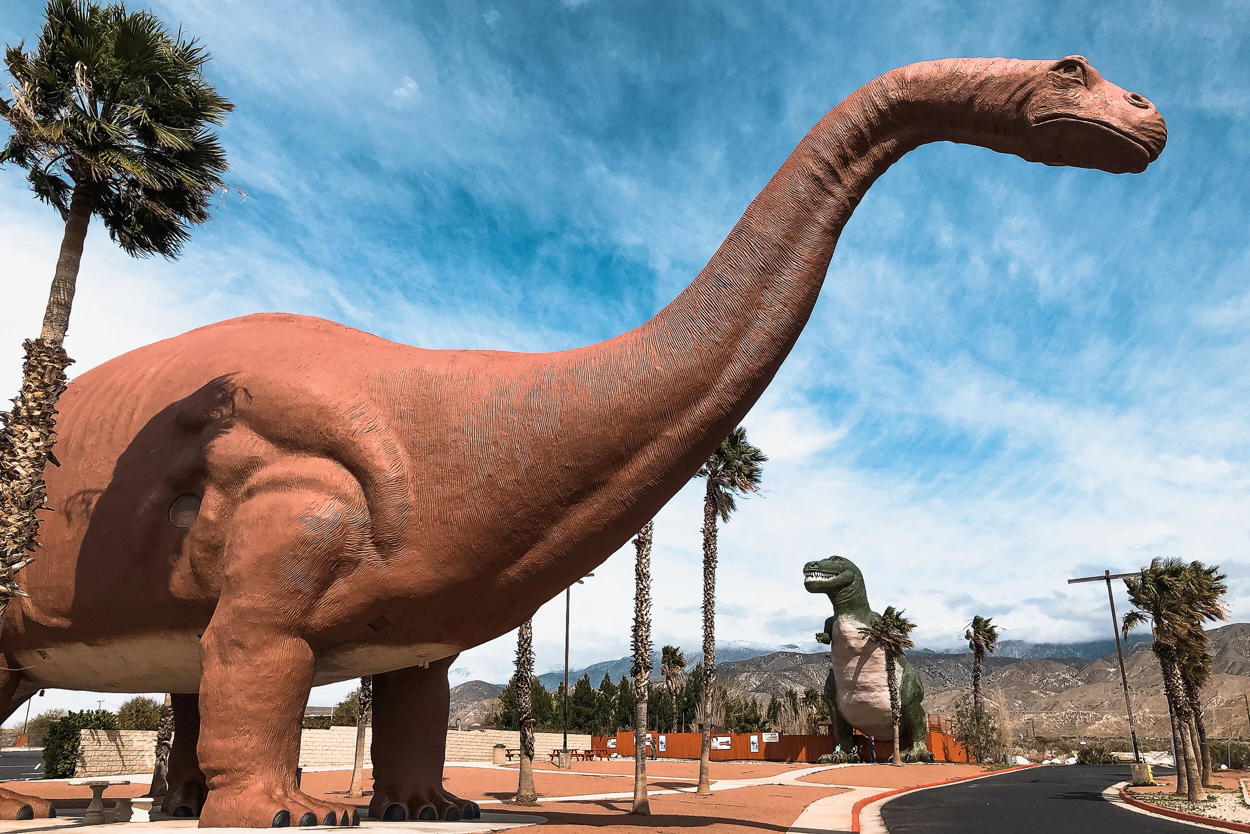
Cabazon Dinosaurs
Located just off the highway in Cabazon, CA, these dinosaurs captured our attention and imagination. This roadside attraction, considered to be one of the greatest, features two giant dinos: A pinkish brachiosaurus named Dinny the Dinosaur and a green t-rex named Mr. Rex. We reveled at, walked under, around and even climbed inside both of them.

Palm Springs Wind Mills
We didn’t make it to Palm Springs but along our way to Joshua Tree, we passed a wind farm with thousands of spinning windmills. They’re hard to miss and mesmerizing to watch as you drive by.
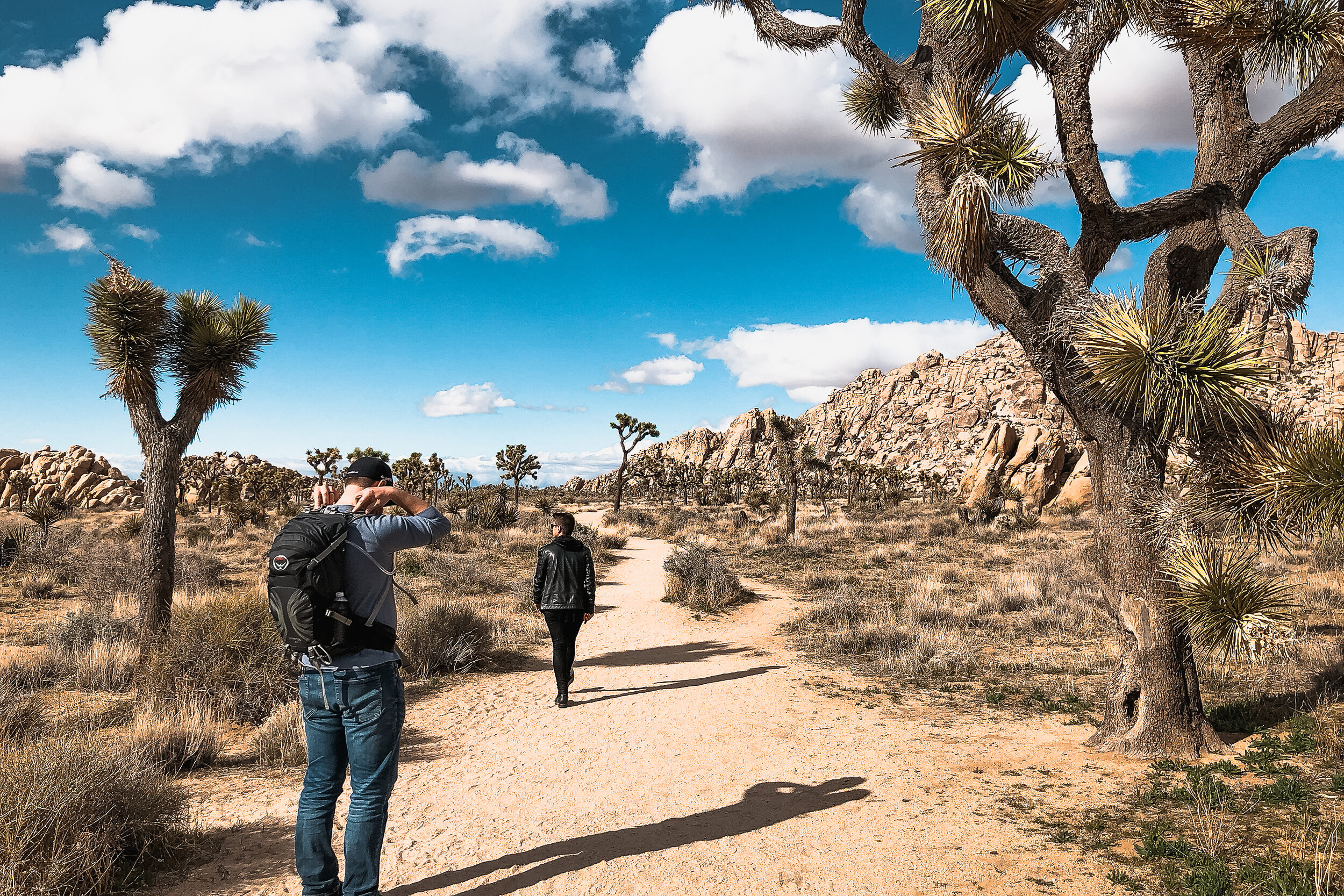
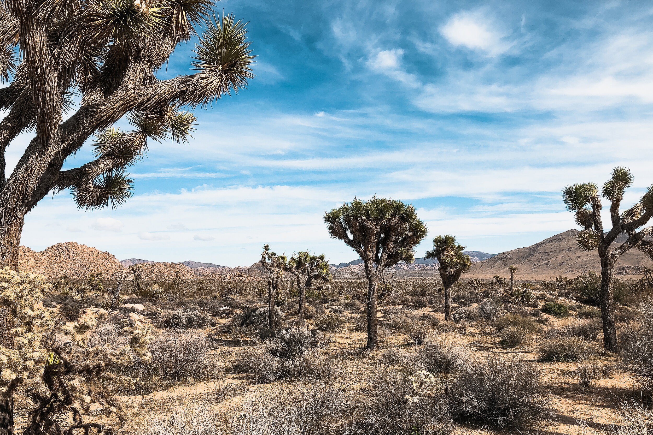
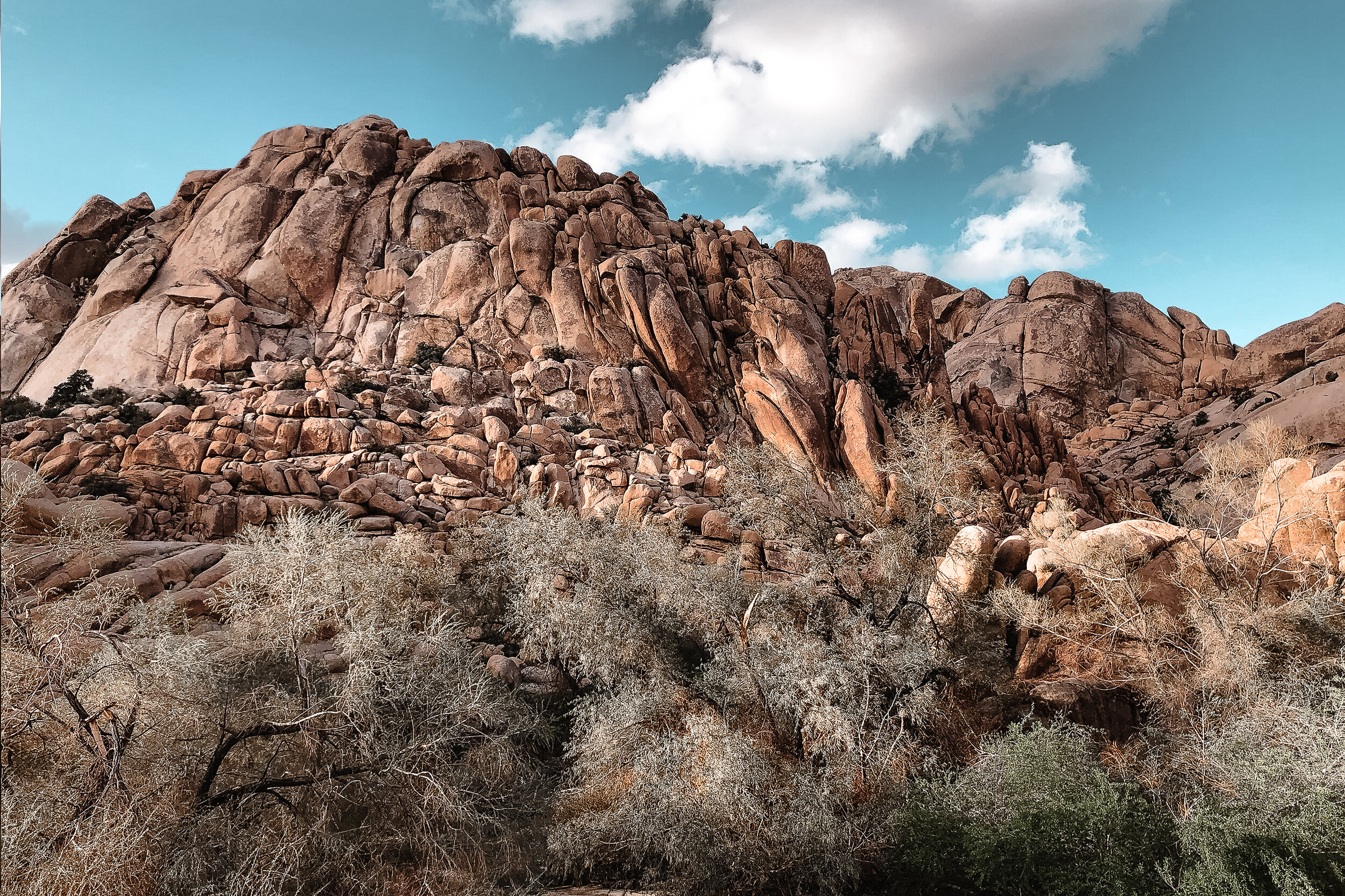
Joshua Tree National Park
The park is famous for its namesake, the Joshua Tree. The tree itself is a multi-armed, spike leaved, desert growing plant. They are a fragile and enduring symbol the the Mojave Desert where the park resides, thriving in harsh conditions with little water and persistent sunlight. In addition to the Joshua Tree, the park is home to many species of cacti, nocturnal animals and smoothed rock formations.

Hiking Trails
There are miles of designated trails to hike throughout Joshua Tree. After entering the park through the west entrance, we drove a little ways and began hiking. I still can’t figure out what trail we hiked but I think it was a combination of several. We spent hours hiking through a forest of Joshua Trees, along some large rock formations and through an area with a wash where we saw a few desert tortoises.
Willow’s Hole Trail
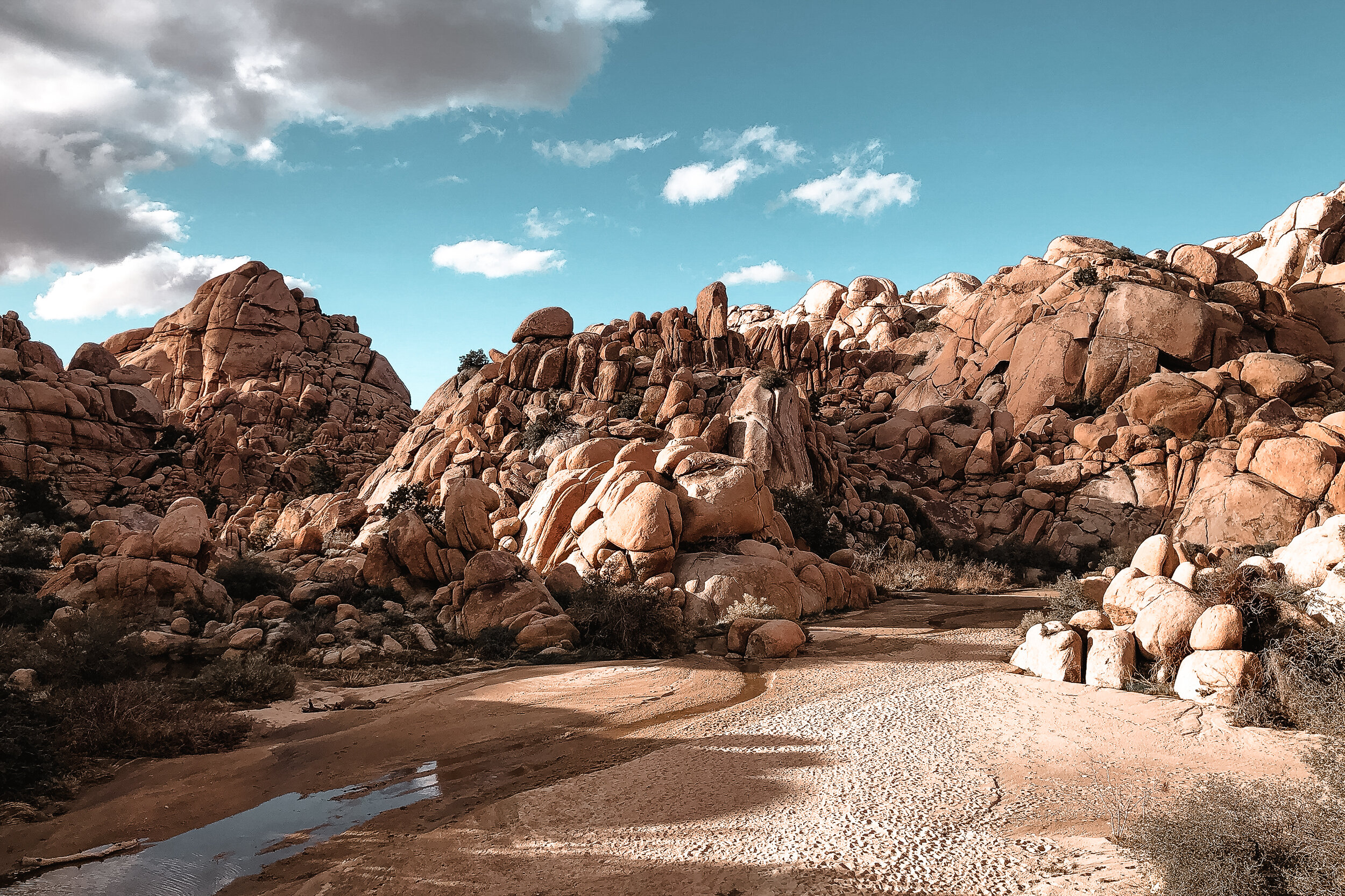
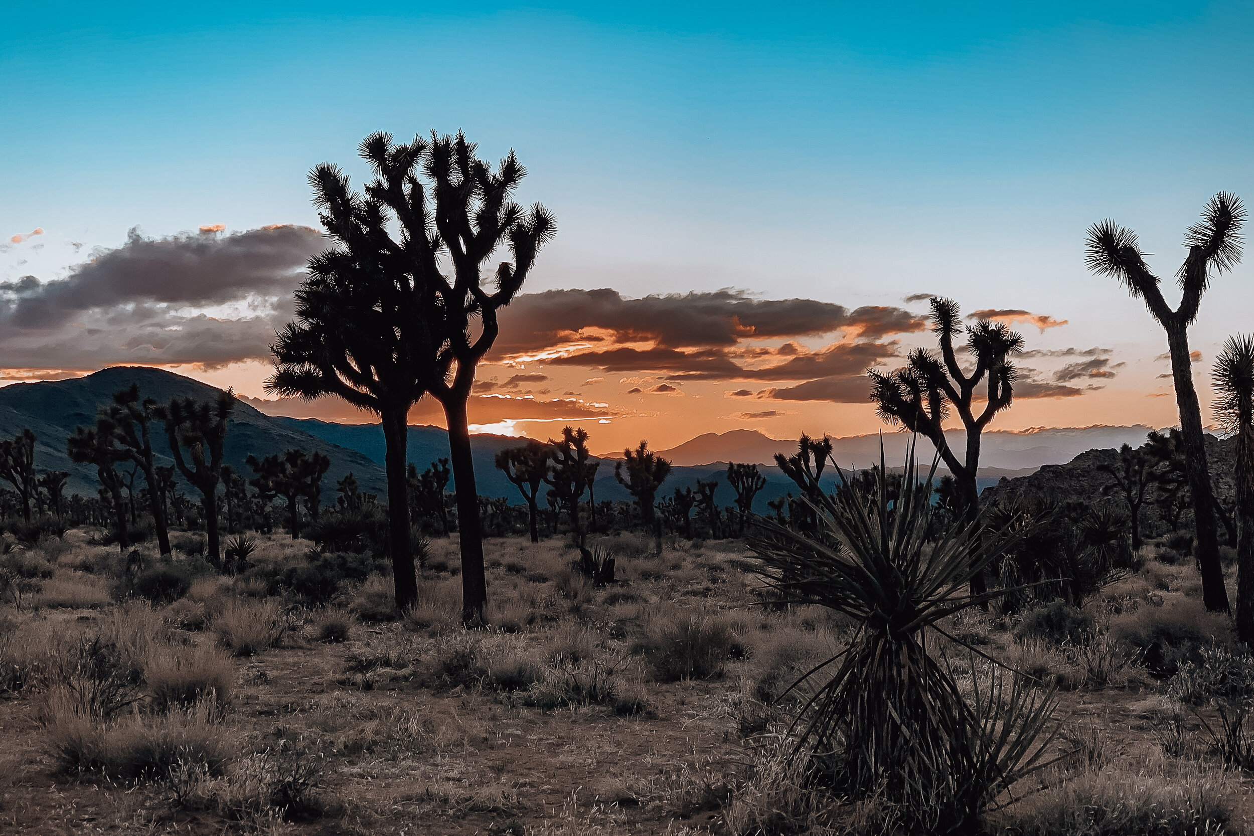
During our second day in the park, we hiked to Willow’s Hole. Considered to be one of the more difficult hikes in the park, we began late in the afternoon and ended at sunset to avoid the heat. The hike is mostly flat, stretches over 7 miles round trip and takes about 4 hours at a normal pace. This trail offers a variety of the entire Joshua Tree landscape ending at a desert oasis surrounded by willow trees.
The hike starts off through a flat terrain surrounded by large rock formations, Joshua Trees and all other kinds of cacti and fauna. Along this part of the trail we saw countless whitetail and jackrabbits. The second half of the trail, leading to Willow’s Hole winds through a canyon of incredible cliffs and washes.
The closer we got towards Willow’s Hole, the wetter the path got. We had to climb over large boulders in order to avoid some the larger pools and streams of water. Near one of the pools, we noticed paw prints from a coyote. We eventually made it to the oasis, it was a serene and peaceful spot to stop and relax before making our way back. The hike back was just as beautiful as the way in, we enjoyed the golden glow of the sunset across the terrain before watching the sky show off its colors.

Maps & Park Pass
Pick up a map from one of visitor centers when buying your park pass. The park pass costs $25 per car and is valid for 7 days. Ask a park ranger where to hike. They often give great recommendations based on what you want to do or see. Click here for a map and list of trails.
Set up a free account with All Trails. Their platform offers detailed info on all of the parks routes from info curated by other hikers.
What to Bring
Water
Food/Snacks
Sunblock/A Hat
Flashlight
A Map
Other Sights
Skull Rock. One of the many rounded rock formations in the park. As the name notes, this one is famous for its skull shape.
Pinto Basin Road. This main road winds from the north to south end of the park and takes about an hour to drive. Most Joshua Trees are located in the High Mojave Desert to the north while the Colorado Desert to the south is known for its its cacti patches.
Pinto Basin. A vast swatch of cacti covered desert surrounded by mountains. It’s easily viewed from the Pinto Basin Road.
Chola Cactus Garden. Located midway along Pinto Basin road is this incredible cactus garden filled with Chola cacti. Watch your step along the trail and don’t touch them.

Ocotillo Patch. Located near the south end of Pinto Basin road is an extensive patch of Ocotillo Cacti. These massive cacti grow several feet high and gracefully sway in the wind.
Night Sky. The High Mojave Desert is located far enough from any major cities making light pollution very minimal and offering incredible night sky views.
Where to Stay
There’s no shortage of places to stay around Joshua Tree. The park itself has a few campgrounds. There are many quaint desert resorts, motels and unique Airbnbs outside of the park. We stayed in an Airbnb Airstream about 20 minutes from the park’s west entrance. It

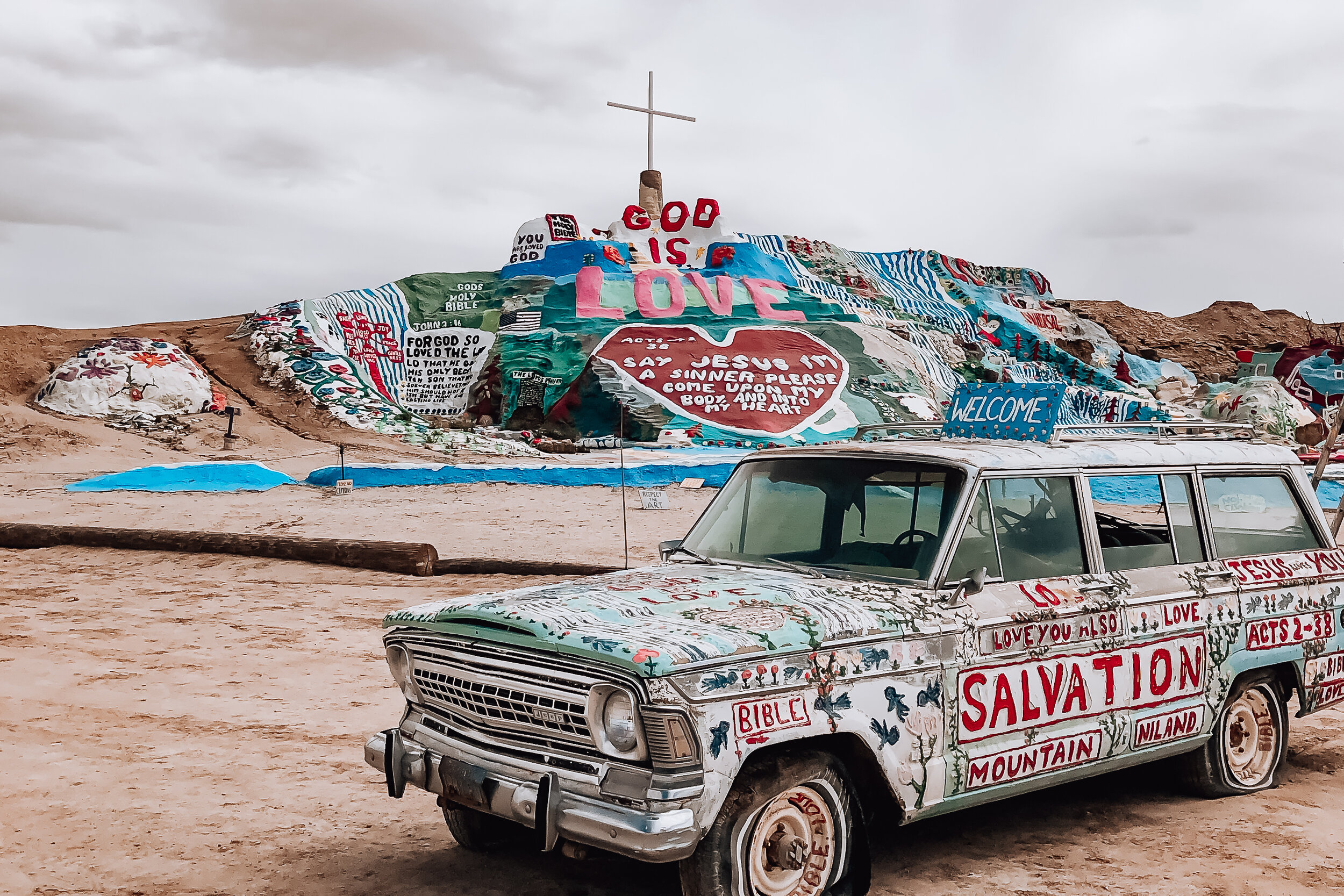
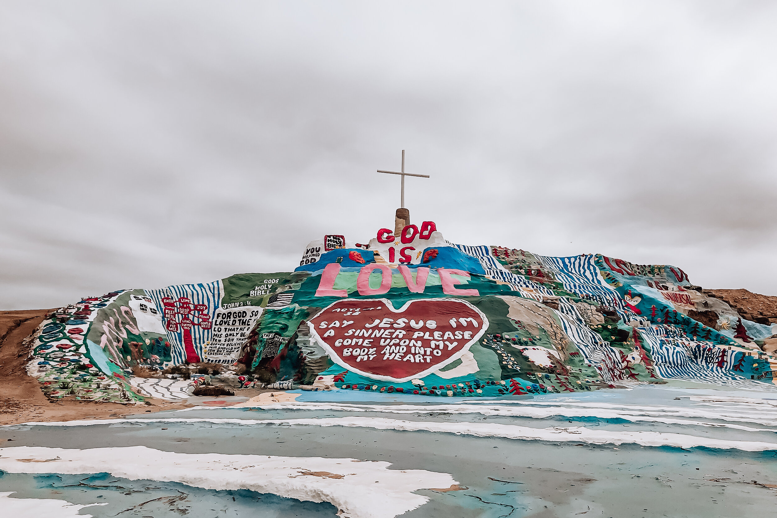
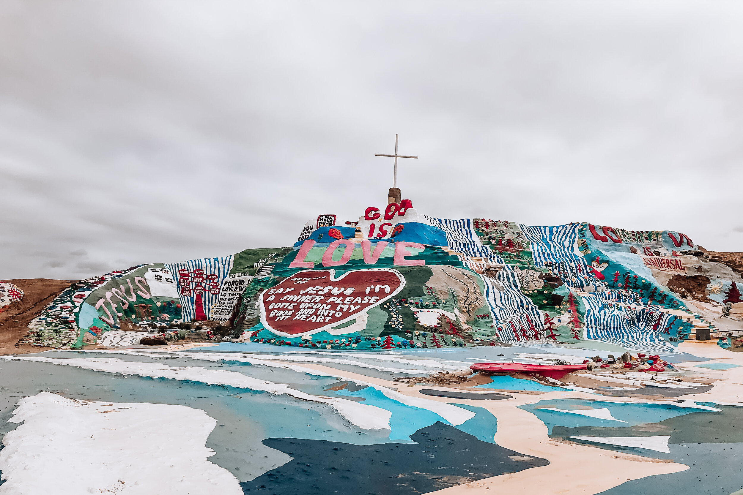
Salvation Mountain
Salvation Mountain is a massive art piece located in the California Desert started by Leonard Knight in the mid 80s. The site is inspired by the scriptural passages with the simple message, “god is love.” Love, in our opinion is the true theme of this place. The mountain is covered in colorful and peaceful imagery of waterfalls, flowers and the yellow brick road centered around the most prominent word, love, situated above a giant heart. The structure is built from a mixture of hay, packed clay and layers of paint. All materials used have either been donated or salvaged.

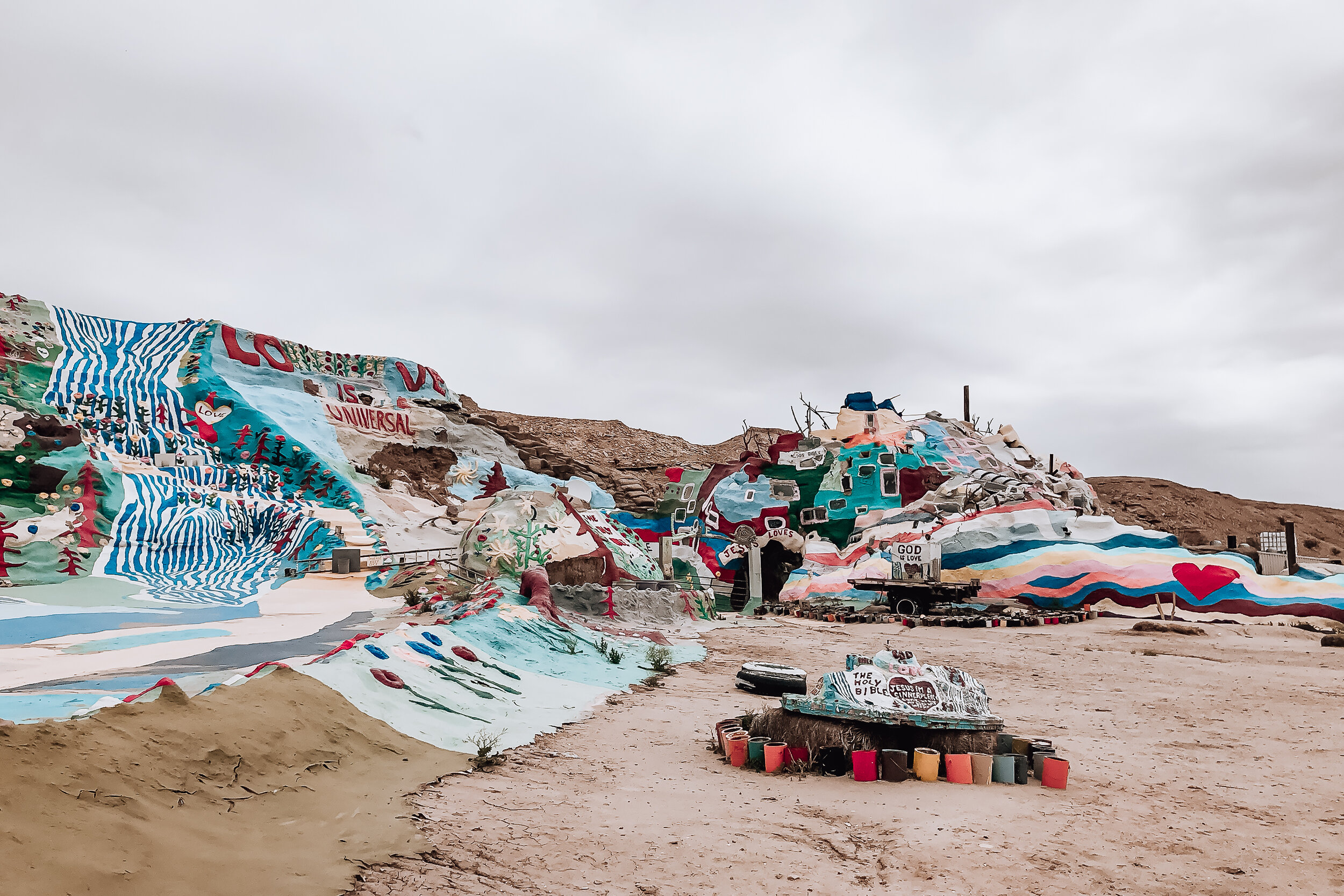
While visiting, we met Ron, the preservationist of Salvation Mountain. He’s leads the repairs and preservation of the massive art piece in line with the artist’s original vision. Ron has been living onsite for several years and mentioned having repaired the entire landmark, area by area, at least twice over since beginning his work here. He reminded us that the desert is a very harsh environment. Something as exposed to the elements as Salvation Mountain requires a massive amount of patience and care.
While we visited, the monument was off limits and only available for viewing. A storm had swept through the area a few days prior causing damage to one of the faces and interior rooms. Ron estimated it might take 6 months to a year to fully repair. Though damaged, this place will never loose its heart. Even from a distance, visiting this place felt special.
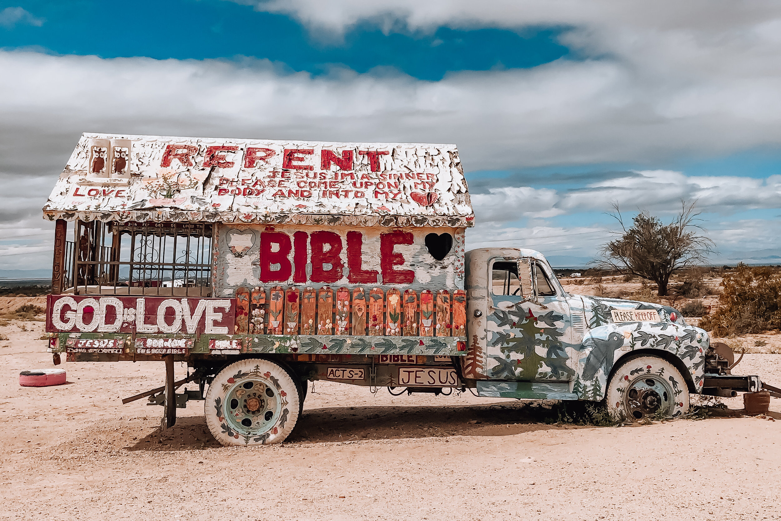
Slab City & East Jesus
Located just beyond Salvation Mountain are two off the grid alternative living communities, Slab City and East Jesus. We spent hours wandering, observing and talking with some of the locals to get a better perspective on the places they call home. If you visit Salvation Mountain, you need to come here with an open mind. There is no where else quite like it.
Slab City. This community gets its name from the remnants of concrete slabs left behind after the demolition of a military training camp. The slabs are home to RVs, permanent trailers, make shift buildings and piles of debris. Many of the folks who live here have come to live off the grid while others are here as a result of poverty. There is no electricity, running water, waste management or government. Despite that, there is a certain since of community with its own library, golf course, clubs and music venues.
East Jesus. A sustainable and habitable art installation focused on creative re-use. The experimental community is built from discarded materials and salvaged waste. It’s inhabited by artists, musicians, writers and other creatives.
Salton Sea & Bombay Beach
Our route to Salvation Mountain lead us along a road with countless washes depositing agricultural runoff into the Salton Sea. Curious, we stopped at a state park and walked up to the sea’s edge, only to notice the decomposing remains of fish and dried clay leading up to the shoreline. Further down the road, we drove through the town of Bombay Beach, a once thriving seaside community catering to celebrities, retirees and vacationers during the mid century. The town, now mostly forgotten is a place stunted in its growth but still inhabited by a number of families and artists. We passed a man painting television screens on the street, two children seamlessly sweeping dirt for leisure and a woman sitting alone on a chair in the middle of an empty lot. Many homes have been left behind due to the toxicity of the sea and damage caused by the salinity in the air. A sobering place, the town and the sea has an incredible history that should’t be overlooked or looked down upon.

Northern Arizona
The Grand Canyon
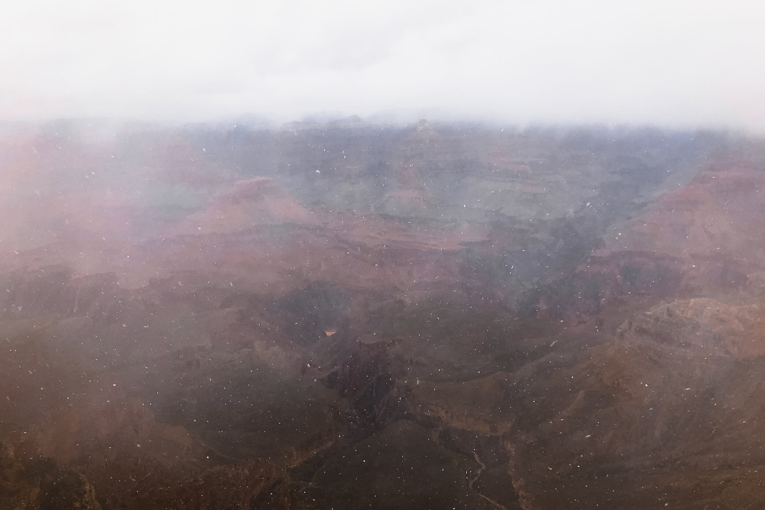
The Grand Canyon is revered as one of the greatest natural sights on earth. Its size at 1 mile deep and up to 18 miles wide, reveals millions of years of layered sediments and colorful rock. After leaving Southern California and heading for Arizona we decided we had to visit. By the time we reached Flagstaff, it had began snowing. As we ascended further into the mountains, the snow turned into a blizzard. Once we reached the South Rim of the Grand Canyon, it was a white out. As we overlooked the canyon, all we could do was laugh, barely able to see a thing. One day, we’ll be back.
Horseshoe Bend
Horseshoe Bend is a 1000 ft steep bend of the the Colorado River in the shape of a horseshoe. It’s an incredibly breathtaking sight and truly awe inspiring. We spent the late afternoon wandering the rim and admiring its beauty. It completely made up for not being able to see the Grand Canyon the day before. Located just off the highway outside of Paige, AZ and accessible by a 1.5 mile hike to the rim. The overlook is open daily from sunrise to sunset for an admission of $10 per car.

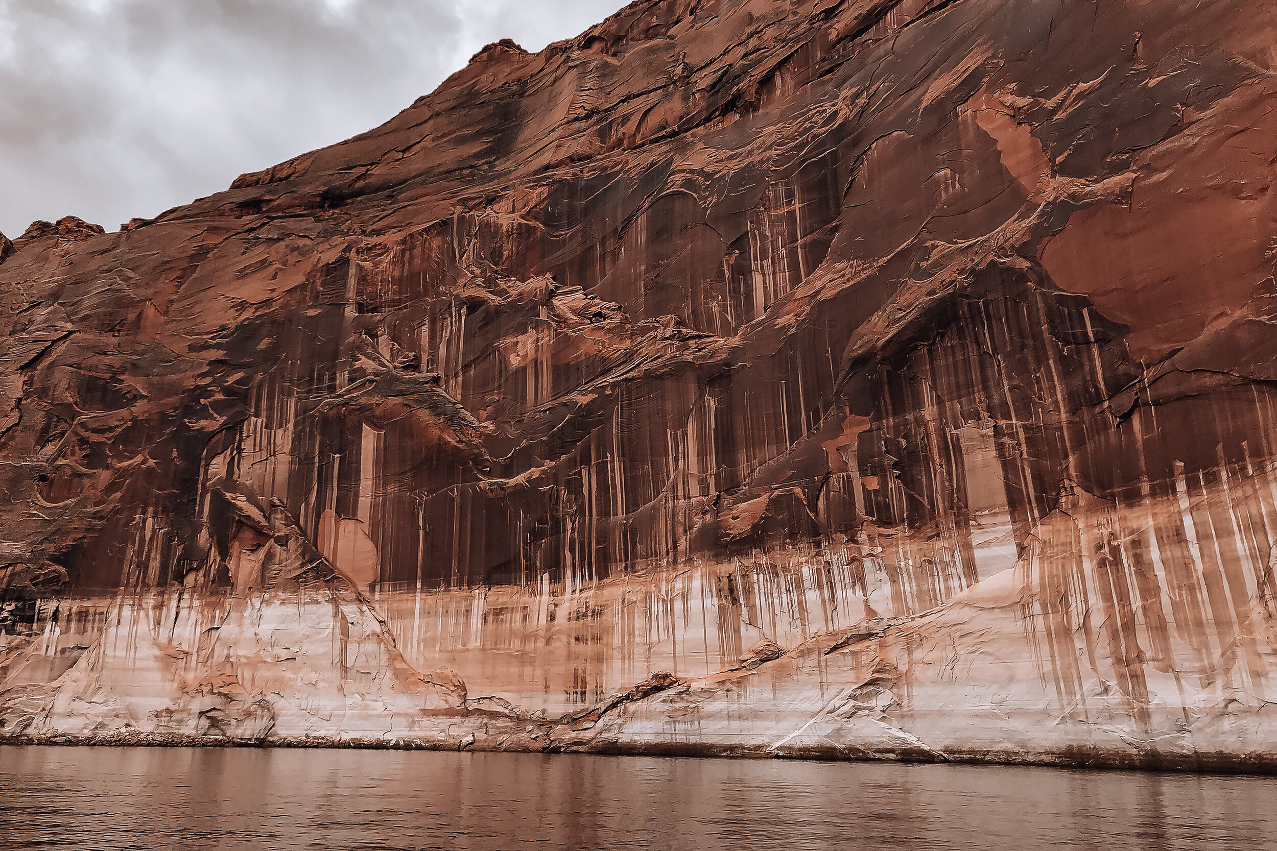
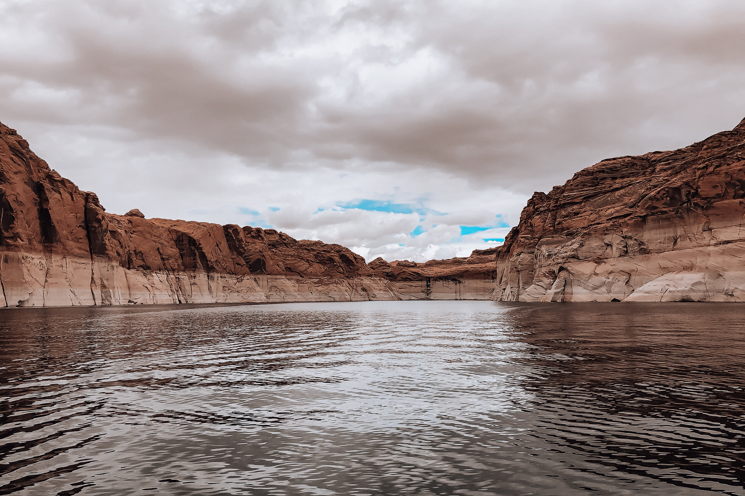
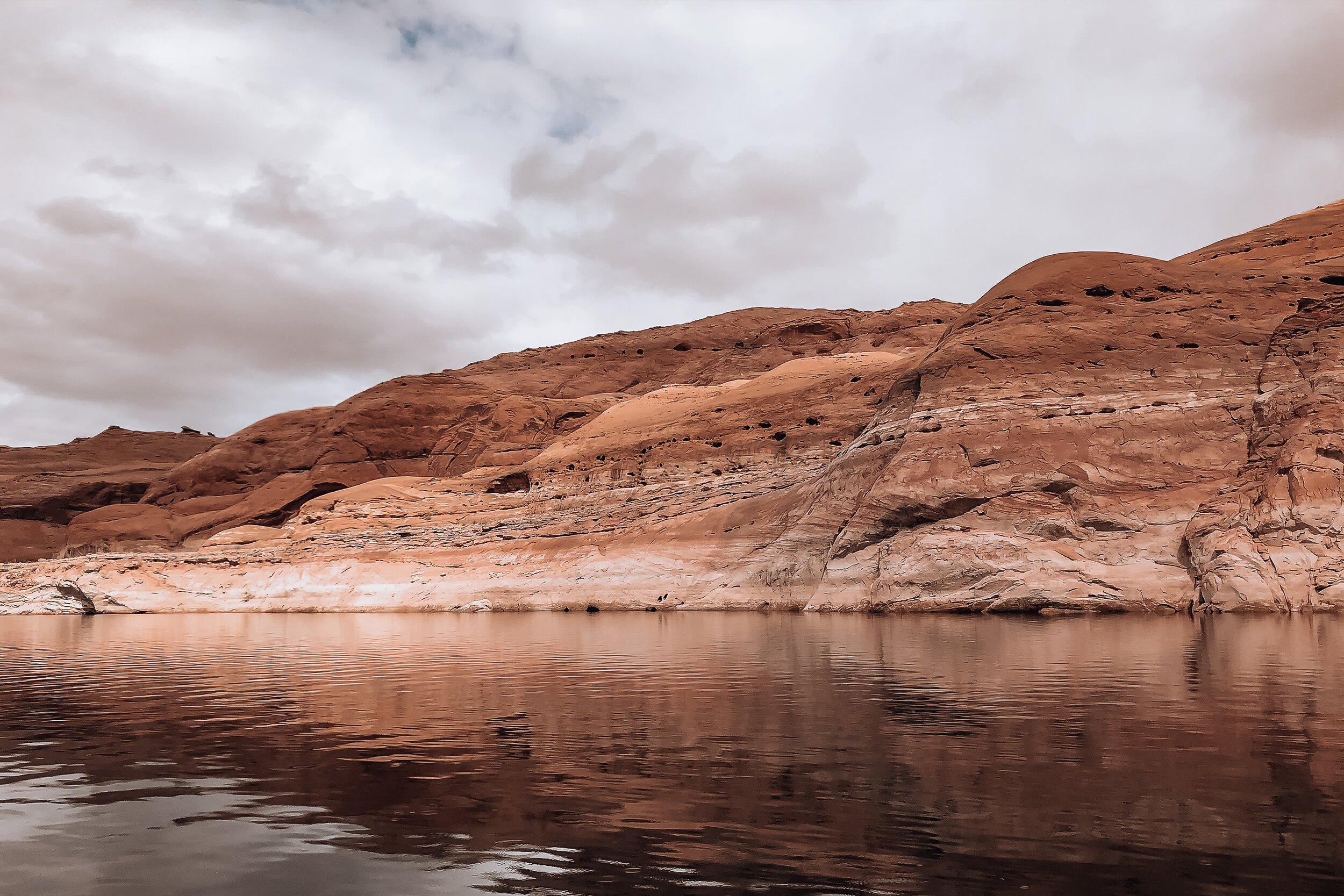
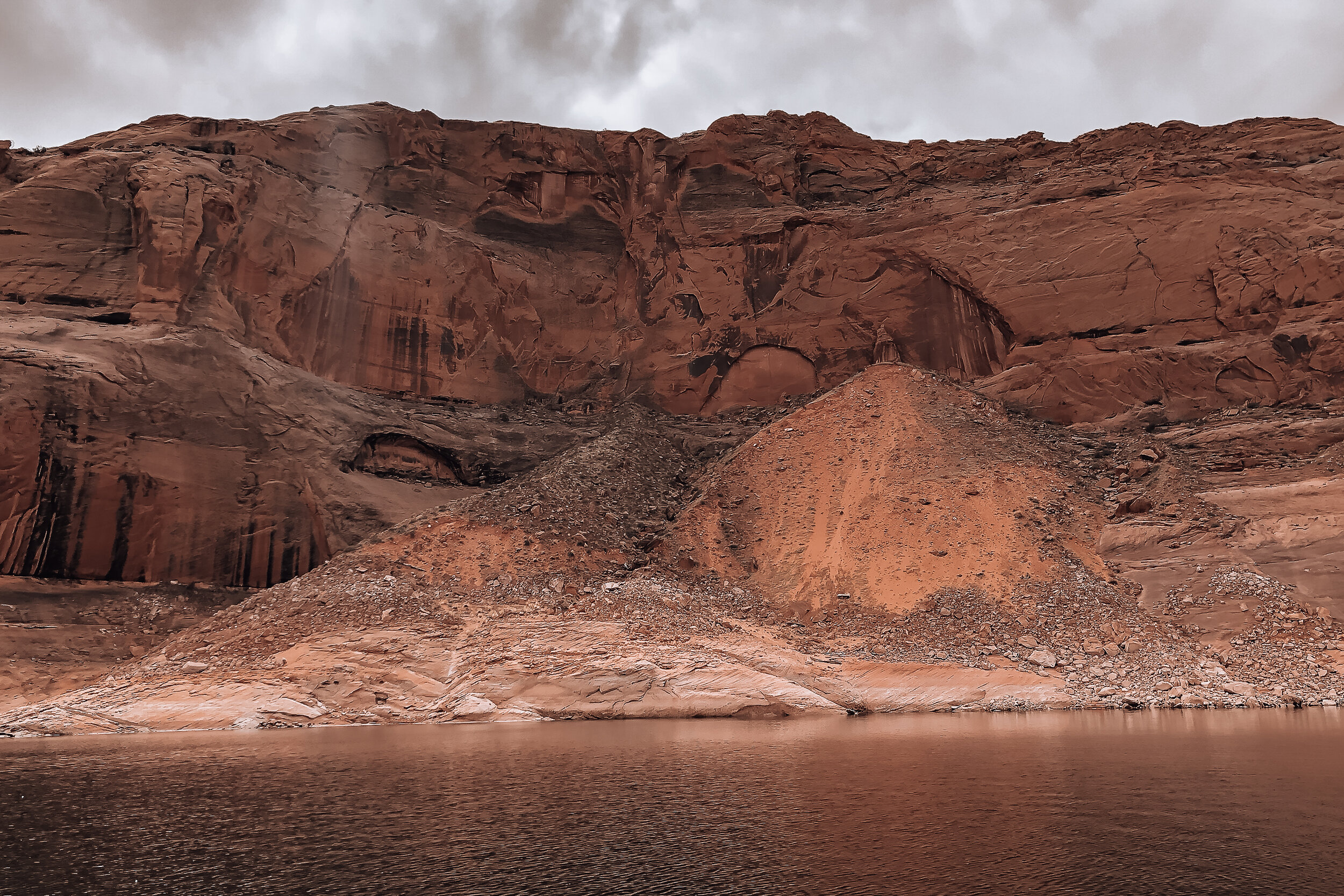
Lake Powell & Navajo Canyon
Lake Powell is a manmade lake created by the Glenn Canyon Dam with over 2000 miles of shoreline. We decided to rent a boat for the afternoon from Antelope Point Marina to explore Navajo Canyon. Navajo Canyon is 16 miles long with massive orange and brown cliffs ranging in height on all sides. The canyon is pretty wide but narrows in areas with tiny offshoots speckled throughout. We slowly and carefully explored one of these before pulling out and boating to the end of the Canyon.


Navajo Cliff Dwellings
On the way to Monument Valley we took a detour to visit the Navajo National Monument and overlook the Betatakin Cliff Dwellings. At its peak nearly 800 years ago, it was home to hundreds of people and contained over 120 sandstone structures, many of which still survive today. It can be viewed at the end of a short hike from the Navajo National Monument Visitor Center

Antelope Canyon. A picturesque, narrow and winding sandstone canyon. It can only accessed via a Navajo tour guide.
Vermilion Cliffs. A sweeping wave of orange and golden shades of sandstone
Tower Butte. A towering 5000ft sandstone butte in the middle of Glen Canyon. There are helicopter companies offering rides to the top of the butte overlooking the sounding landscape
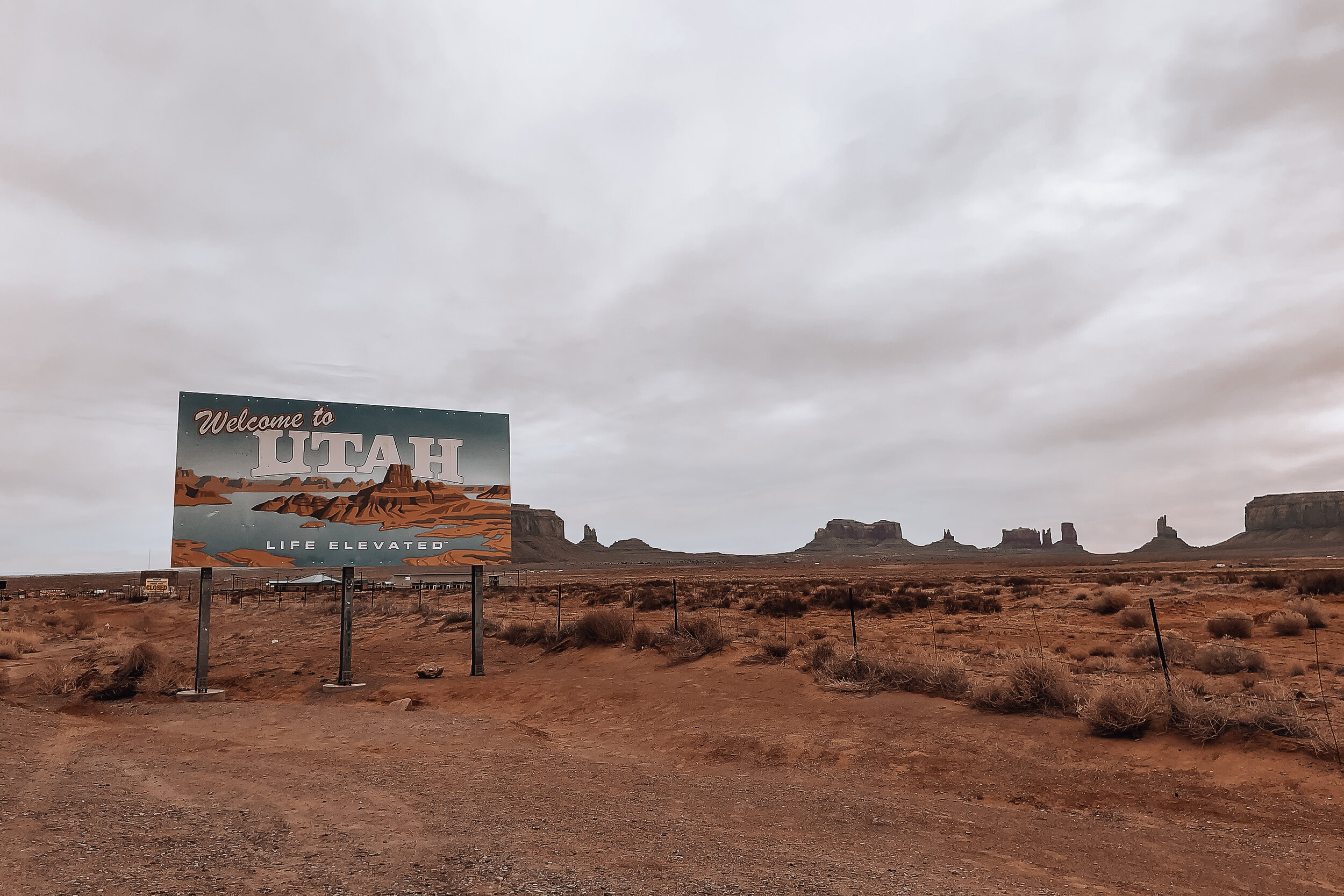
Utah
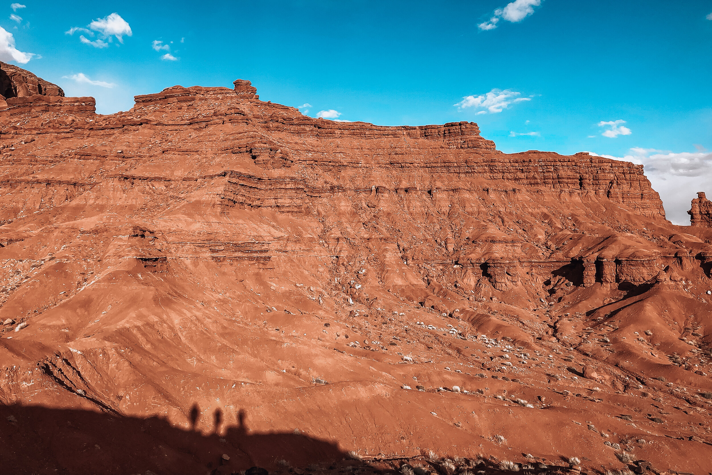
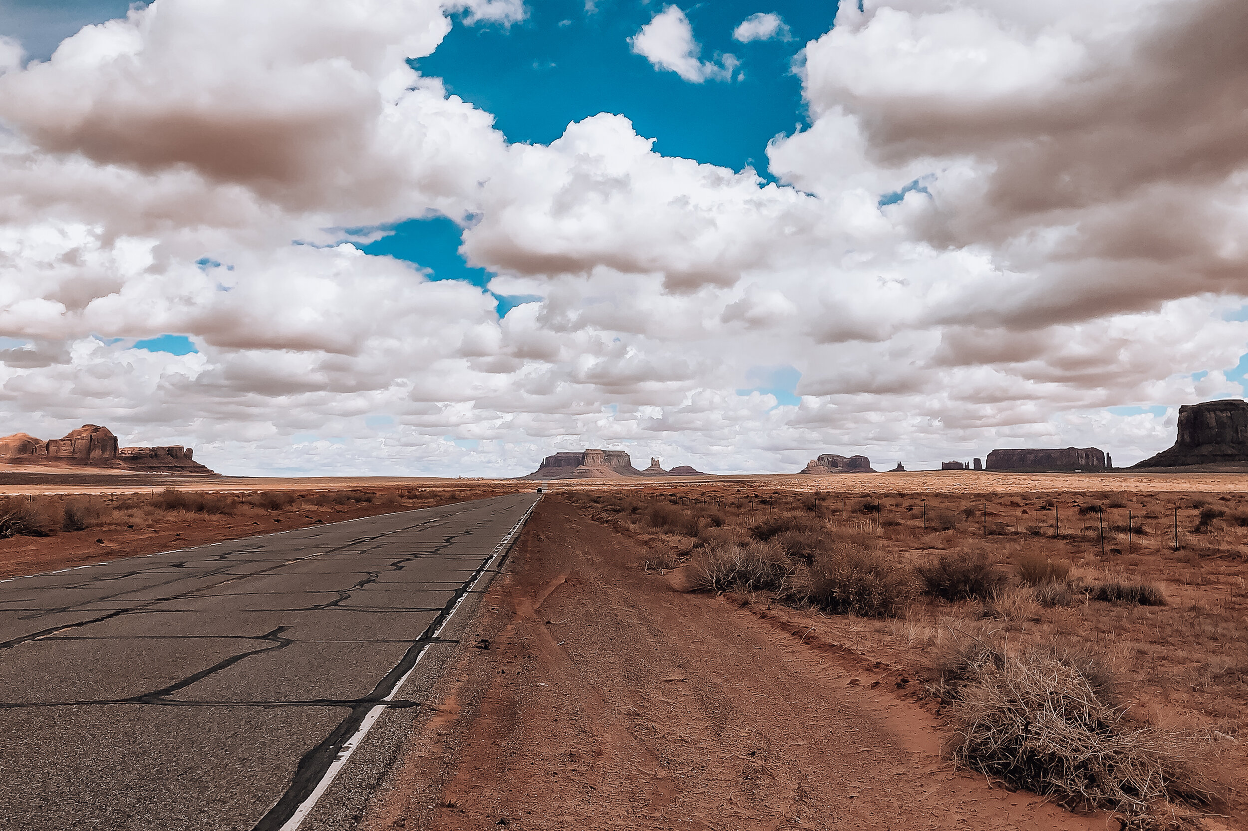
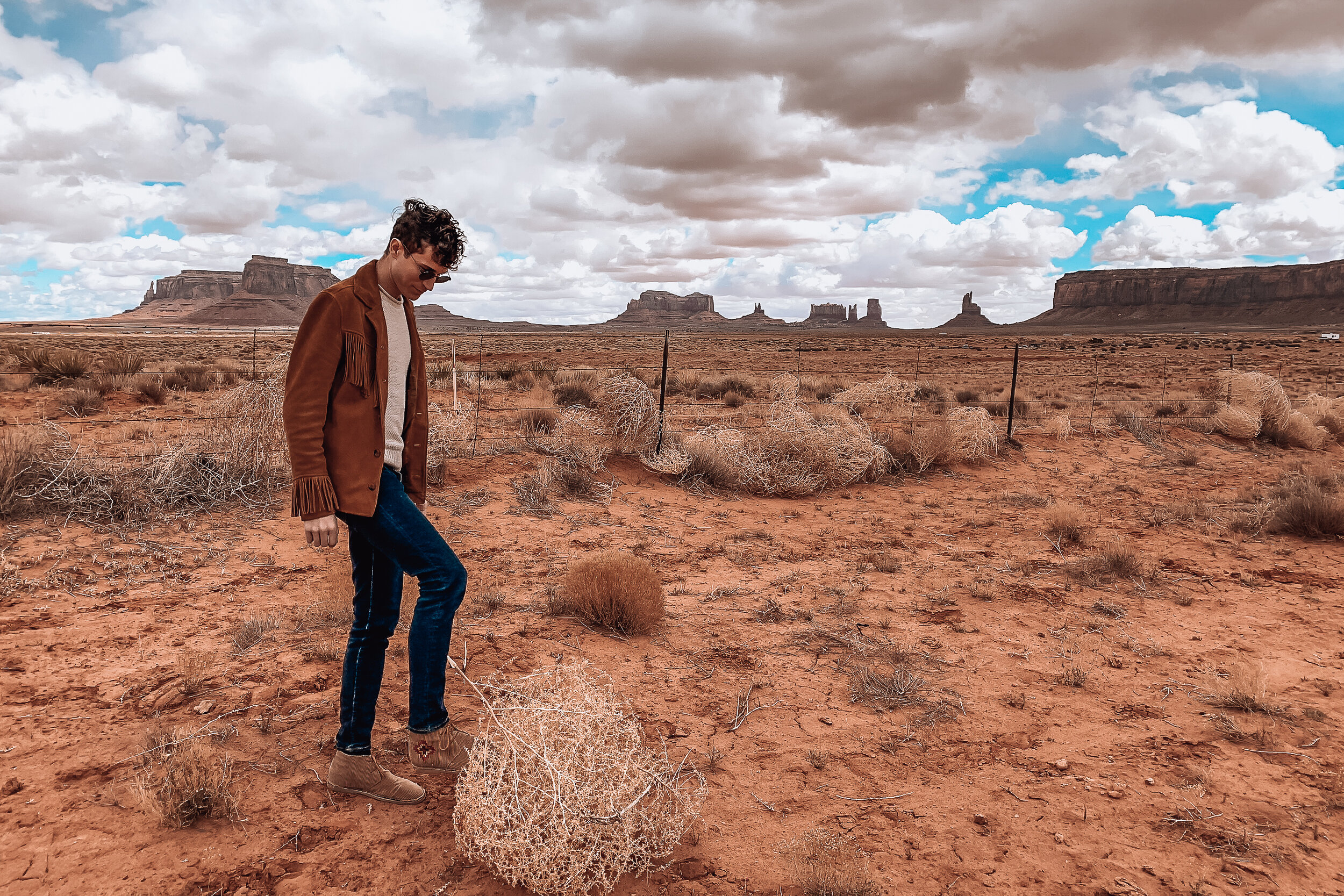
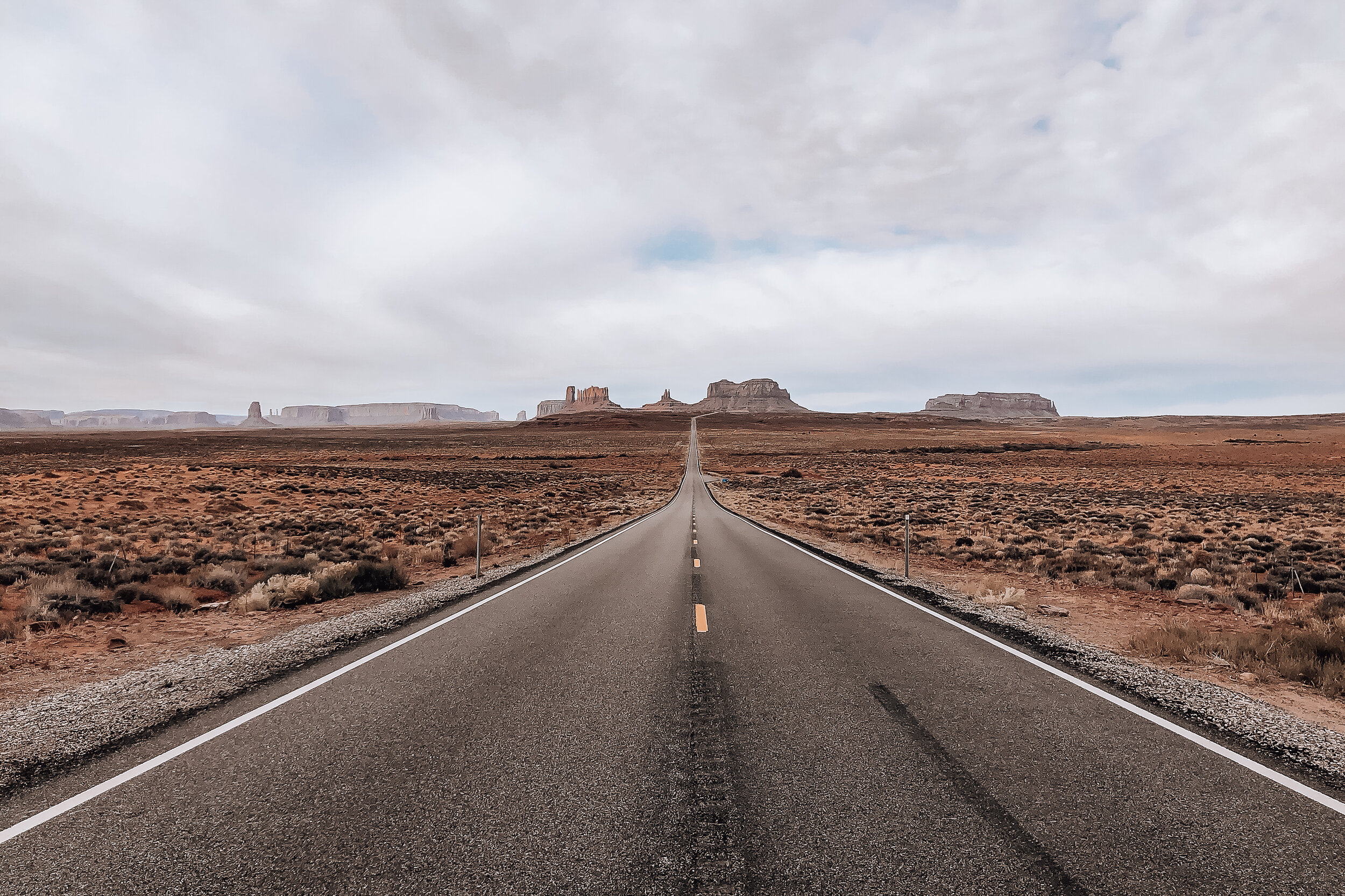
Monument Valley
Monument Valley offers views of the most quintessential western scenery and landscapes. The valley is made up of massive crumbling rock formations known as buttes. The buttes were formed millions of years ago by tectonic activity and erosion forming the structures visible today.

As we drove towards Monument Valley, we could see some buttes rising above the horizon and the clouds becoming a tinted orange color. We learned this is due to red dust particles in the clouds as well as the reflection of the soil.
The valley resides on the boarder of Utah and Arizona within the Navajo Nation. When we visited, the park had just closed due to the outbreak of Covid-19. However, many of the buttes and mesas are visible from roadside overlooks. Within the park is a loop of road that drives through the center of the three most famous buttes: West Mitten Butte, East Mitten Butte and Merrick Butte.
Staying in Monument Valley, with a host on Airbnb, we were still able to hike around the valley outside of the park. Our host directed us to the nearby Sentinel Mesa which had a trail leading to its plateau. Lead by a local dog, we hiked and climbed our way to the top. The path was a bit ambiguous the steeper we hiked but we eventually found our way. Once we reached its plateau, we saw what I would say is the highlight of our trip. We stood overlooking the valley with picturesque views of the entire landscape.

Hogan
Staying within the valley was an unforgettable experience. We spent the night in a Hogan, a traditional Navajo home. The Hogan is a domed structure built from cedar trees and covered in sand and clay offering a level on insulation from the heat and cold. The interior was rustic and cozy with multiple beds and a wood burning stove. The one we stayed in was built in 1934 and has been maintained ever since. Today, most Navajo People live in modern homes but keep a Hogan on their property for guests and ceremonial purposes.

Forest Gump Hill
Many movies and Hollywood scenes have been filmed in Monument Valley. One of the most notable, non-westerns, is a scene from Forrest Gump. Along the stretch of road through the valley is Forest Gump Hill. This is the spot Tom Hank’s character stopped running after 4 years crossing the country.
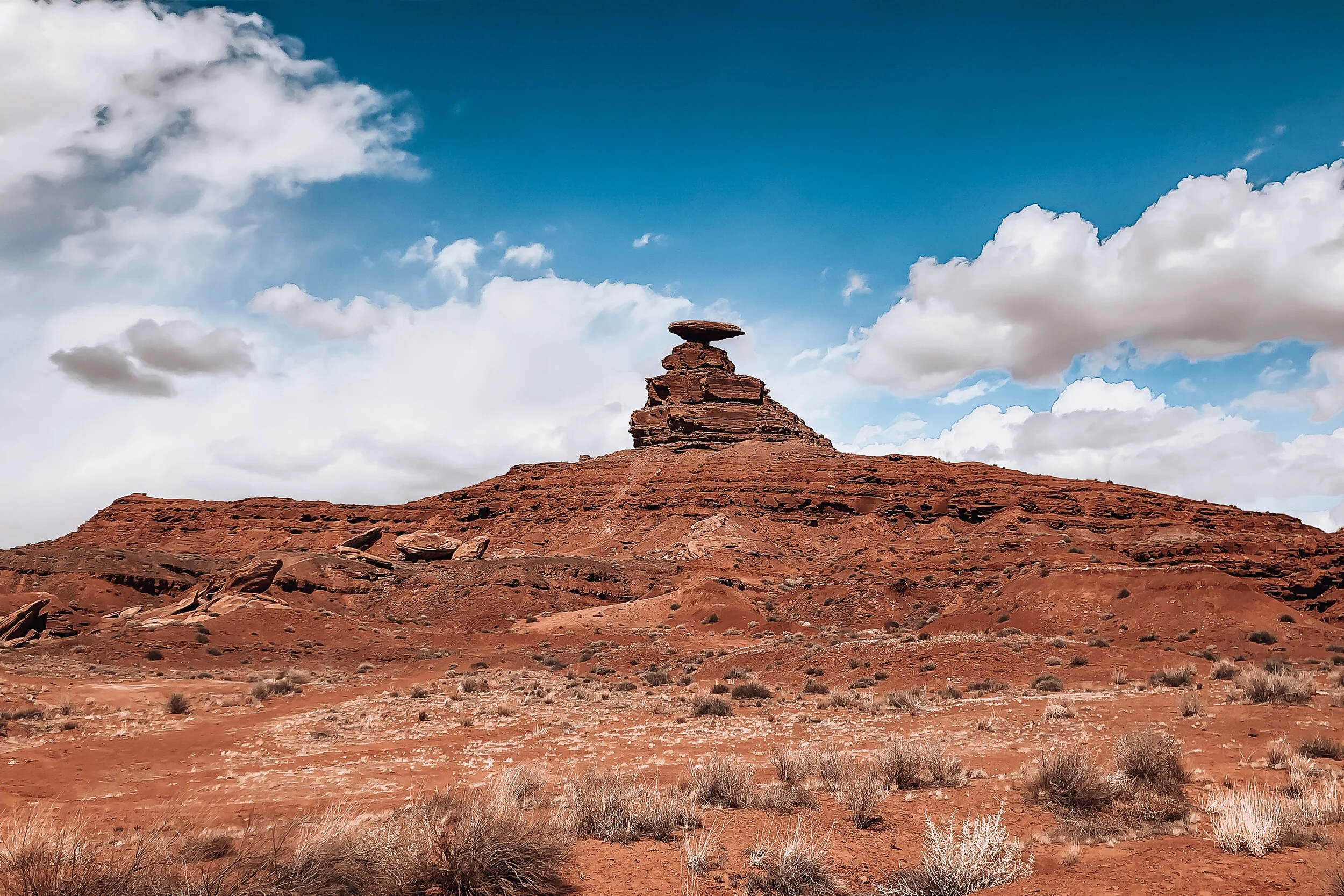
Mexican Hat
Mexican Hat is a rock formation named after A large flat rock, precariously balanced on top of a small vertical base protruding from the hillside. You can hike around the base and climb up to the underside of the “hat.” From here, there are beautiful views of the green and orange hillside carved out by the San Juan River.
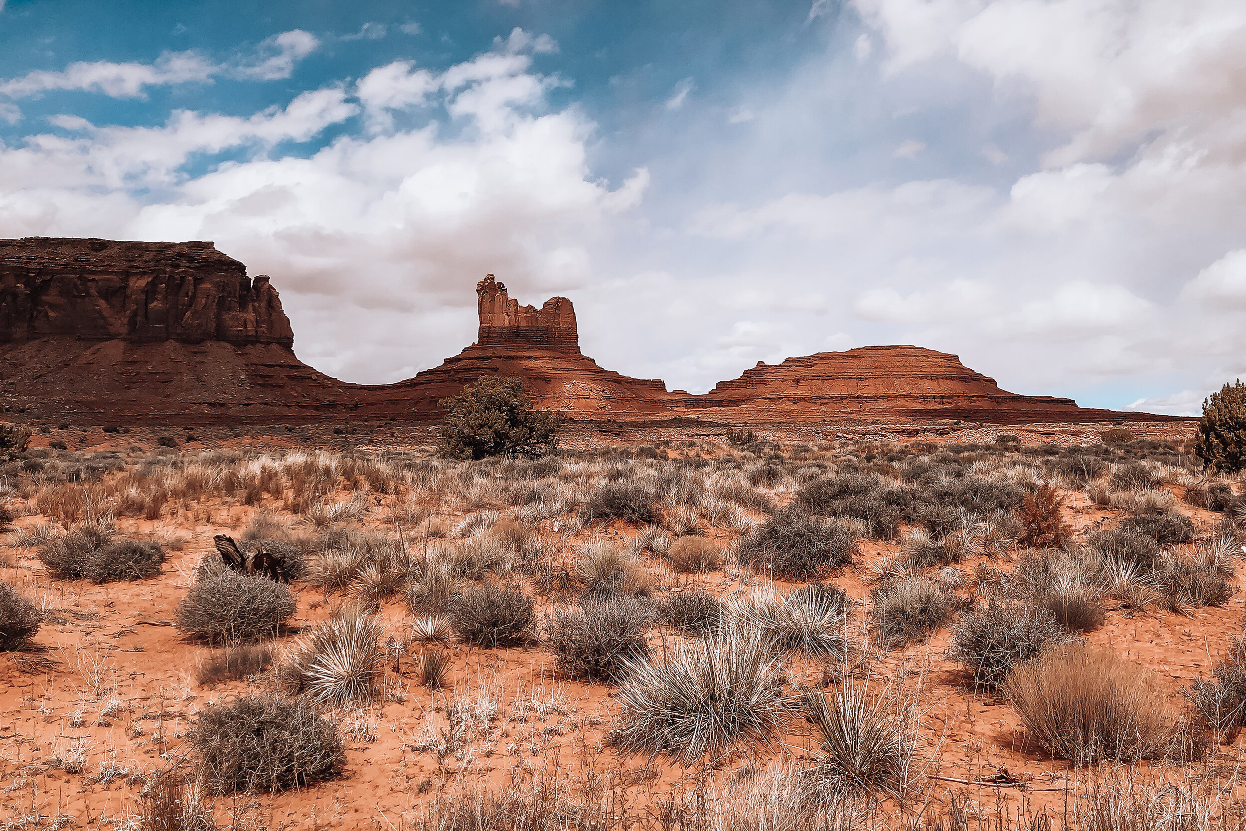
Valley of the Gods
Near Monument Valley and Mexican Hat is another area famous for its rock formations, buttes and mesas. It is a smaller scale version of Monument Valley with grand views and hiking trails.
Navajo Frybread
One of the staple foods we ate was Navajo Frybread. It is a flat piece of dough fried in oil. We had it served two ways. The first way was as a taco, covered in bean, tomato, lettuce, onion and cheese. The second way was lightly covered in a sugary syrup. Devin being a baker, bought a 5lb bag of Navajo Frybread to bring home.
Central Arizona
One thing we learned across our road trip is that Arizona is massive. The climate and landscape changes from desert to mountain, cacti to pine forests and snowy to scorching heat. On our way to the southern side of the state we visited a number of roadside sights and national parks.
Holbrook, AZ
Midway through the state is the town of Holbrook. This town is famous for its roadside Americana charm and western history. Located off old Route 66, the downtown stretch is lined with old buildings surviving from the wild west, retro roadsigns and its famous tee pee themed hotel. The town is nearby the Petrified Forest National Park and has its share of rock shops and attention grabbing roadside dinosaurs.

Wigwam Motel
We stayed the night in Holbrook at the Wigwam Motel. This is the famous concrete and steel formed tee pee motel lined with vintage cars and a retro neon road sign. The motel has 15 tee pees, each acting as their own guest room. The stay was incredibly cute and felt like we had transported to a different era.

Petrified Forest National Park
The Petrified Forest is a National Park covering a flat area of desert that was once home to an ancient rainforest. Preserved under the soil and exposed due to erosion are the remains of fossilized trees from the forest that existed over 200 million years ago. Some of the trees are so well preserved that you can count the rings and feel the grain of the bark.
Located about an hour from west of Holbrook, we drove through the Petrified Forest. We stopped to explore the Blue Mesa, an area of the park eroded by rain revealing colorful bands of blue, purple, grey and red soil as well as the petrified wood. We drove around the exterior loop, wandered its interior then walked through the Blue Mesa trail. Throughout all areas are massive logs and fragments of the trees laying across the ground. It was crazy to think that we were walking across land where the dinosaurs roamed and a forest thrived over 200 million years ago.

Barringer Meteor Crater
Midway through the state is a giant meteor crater formed over 50,000 years ago and measuring nearly a mile across and over 500ft deep. The crater is accessible to view through the park’s visitor center and has two decks that overlook the crater from its rim. Within the visitor center are a large number of meteorites on display as well as small fragments of it for sale.

Meteor City
Further down the highway is the abandoned roadside attraction of Meteor City. It was started in the late 30s as a gas station, grocery store and souvenir stand along the old Route 66. It’s an eerie spot to walk around and watch trains pass by.
Southern Arizona
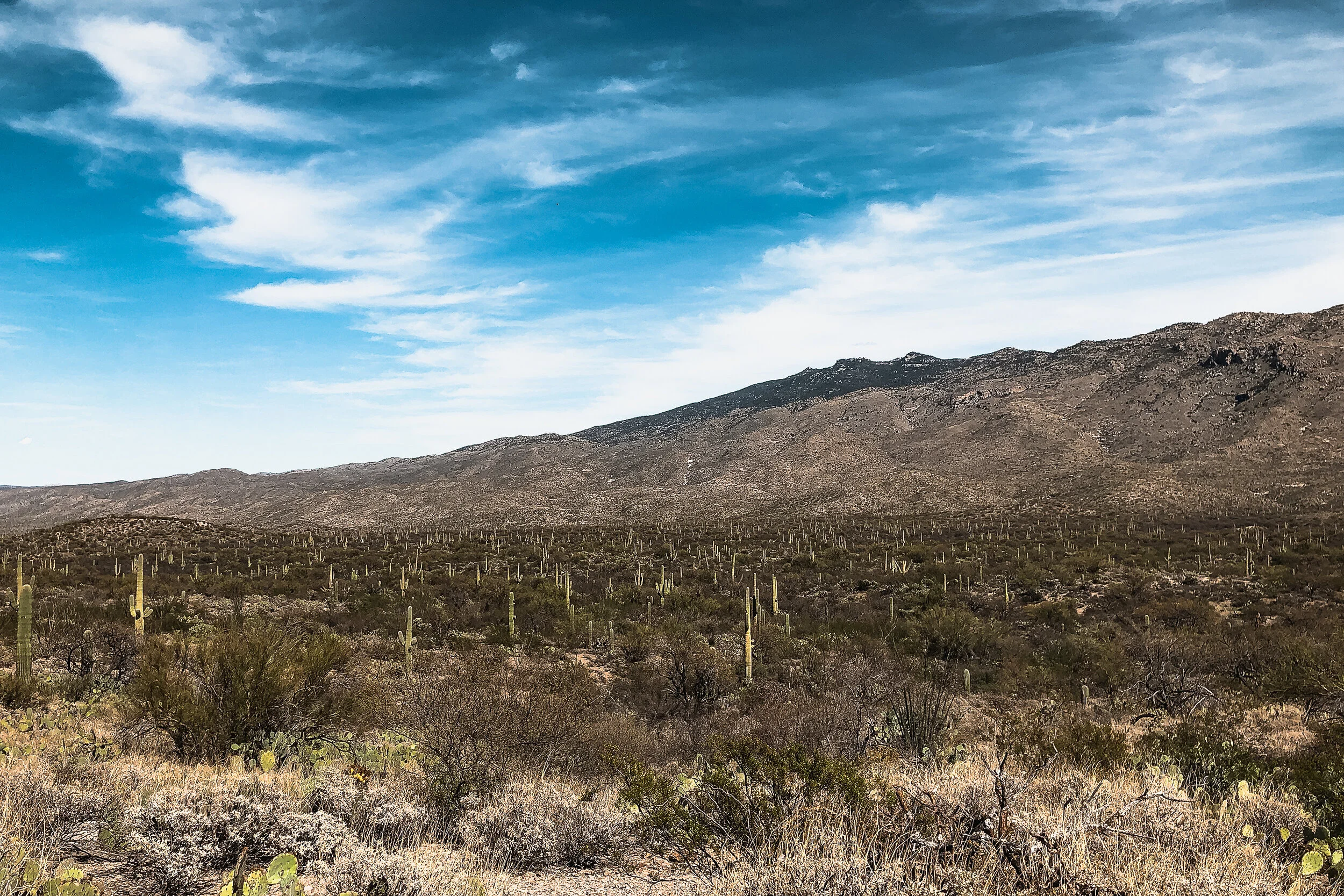
Saguaro National Park
Located within in the Sonoran Desert outside of Tucson is Saguaro National Park, home to the Saguaro Cactus. The Saguaro is the classic symbol of the Southwest with its tall waxy green trunk and multiple arms. The park is divided into two separate districts located on opposite sides of Tucson. The Tucson Mountain District is to the West and the Rincon Mountain District to the East. We visited the east park and easily spent the whole day here.

Throughout the day we drove around the park’s loop surrounding the Cactus Forest, stopping to explore multiple hiking trails. The hike through the Cactus Forest was our favorite. It took us through a desert terrain densely populated with mature saguaros. There was one main trail through the forest any many offshoots which made it easy to get lost while exploring. Luckily, we knew the forest was surrounded by road so we weren’t too worried about loosing our way. Though so close to civilization, it truly felt like the wild west. We even spotted a diamond back rattle snake slithering across our path.
Tucson’s Barrio Viejo
A historic neighborhood with old adobe buildings, all painted vibrant colors and landscaped with desert cacti. Barrio Viejo is one of Tucson’s first neighborhoods, influenced by Mexican American heritage. It is a stunning area to explore and imagine living in.

Getting Around
For a road trip, you need a car and at least a half tank of gas at all times. Not owning one ourselves, we rented. Throughout the trip, we drove nearly 3000 miles, more than I’ve driven in the past 6 years combined. Once we began driving, the miles seemed to pass by. However, while driving long distances, it always took longer to get somewhere than expected. We found it best to allow extra time for roadside stops, detours and traffic. For our first road trip, we consider it a success. We can’t wait to revisit the southwestern highways and visit many of the other sights the region has to offer.
For Next Time…
If we had at least two more weeks to aimlessly drive throughout the Southwest, I can guarantee there is so much more we would have stopped to see and do. Below is a short list of some of those places:
Spend more time in LA
Drive up the Pacific Coast Highway in California
Visit Sequoia and Death Valley National Parks
Return to the Grand Canyon to hike
Visit some of the sights we missed in Paige, AZ
Explore Sedona, AZ
Spend time in Albuquerque and Santa Fe New Mexico
Track down the lightening rod project in New Mexico
Visit the West District of Saguaro